Today we talk about photogrammetry, one of the techniques that has gained more weight in recent years in virtual and augmented reality projects, to the detriment of other options such as traditional object modeling.
In summary, we can define photogrammetry as science or technology whose purpose is the knowledge of the dimensions and position of objects in space, to obtain information through images acquired by sensors and thus create reproductions totally faithful to the original. It is therefore about integrating objects, locations or people in a realistic and detailed way in a virtual world.
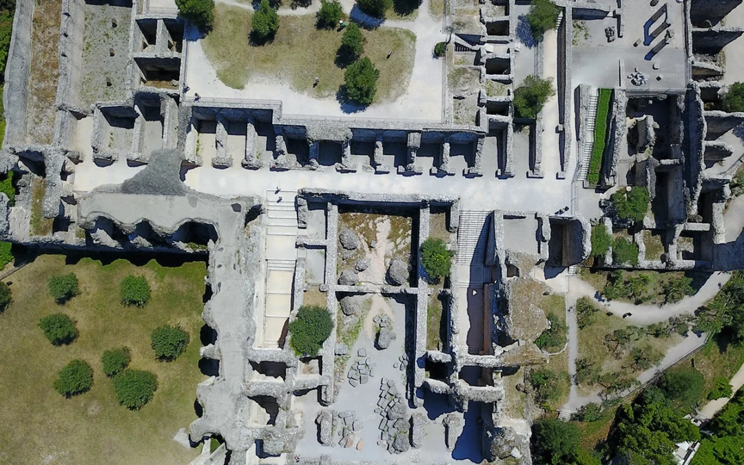
It is a technique commonly used in fields such as cartography, architecture, archeology, heritage conservation and more recently in the development of virtual reality based projects and games.
Its operation, in general, is based on an imitation of human vision, which is capable of capturing the third dimension: objects, people, locations, etc. are scanned.
BASIC PRINCIPLES
The fundamental step in any project made with photogrammetry is to have different points of view of the same object that, once processed, will achieve an effect similar to the human version, which is capable of capturing the third dimension.

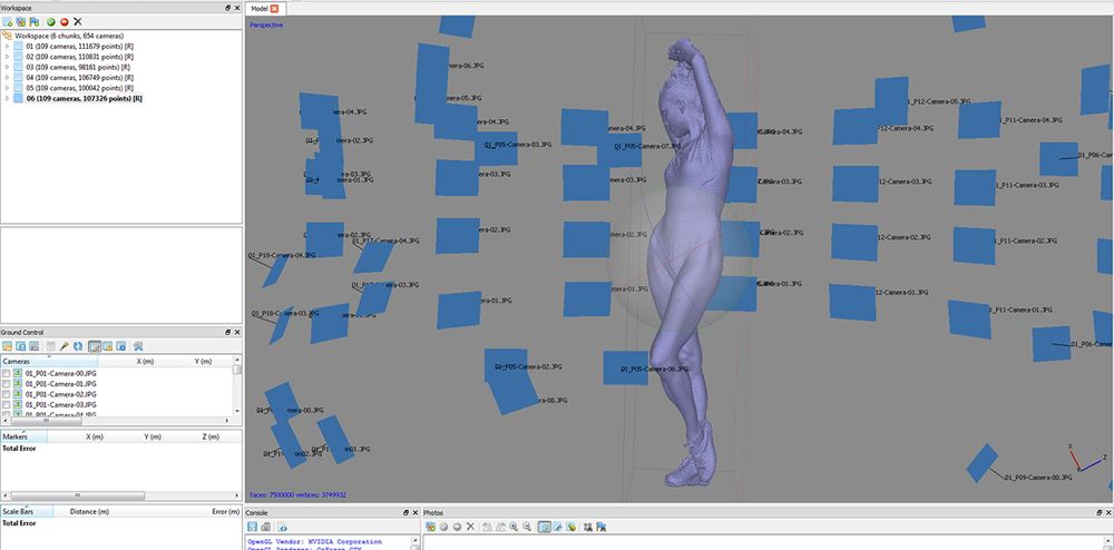
This is achieved by photographing said object from all possible angles for later, and by means of an image processing program that interprets those photos and creates a cloud of points from which a geometry and a texture are extracted with which the 3D object is created. . Then it must be cleaned, optimized and adapted to the final project where it will be integrated.
IMAGE PROCESSING
To use photogrammetry it is necessary to have a good knowledge of photography with a reflex camera, as well as lighting and handling of processing programs and render engines.
Ideally, the object should not be transparent or metal, as this produces glare that can confuse processing programs. For the same reason you must avoid very strong shadows. The ideal is to make use of artificial and controlled lighting.
First of all, you must take the photographs that will allow us to reconstruct the object. These images should collect all the important details. It is also important that there is overlap between them to ensure that the computer can interpret the points of variation, since photogrammetric systems rely on parallaxes to calculate the three-dimensional position of objects.
The next step is to transfer the images to the computer, where processing will begin with programs such as Agisoft PhotoScan in which they will make adjustments such as establishing key points, link points per photo, excess points will be eliminated, etc., until generating u polygonal model and create the corresponding texture.
These are some of the programs that will allow us to re-dimension objects:
• 123D catch (Free)
• Arc3d (Free)
• PhotoScan (Payment)
• Remake “Memento” (Payment)
• PhotoModeler (Payment)
• PhotoSculpt (Payment)
• Capturingreality (Payment)
FORMACIÓN
Las ofertas de formación, tanto presencial como online han crecido exponencialmente el los últimos años. A continuación os indicamos una relación de algunos centros y cursos virtuales donde podemos introducirnos en el mundo de la formación fotogramétrica. Aunque muchos de ellos están centrados en la fotogrametría adaptada al patrimonio (uno de sus principales usos) la técnica aplicada es común a cualquier proyecto de otra naturaleza.
Photoscan: Fotogrametría con Rpas y terrestre de Imasgal
Curso de Introducción al Análisis Fotogramétrico Aplicado con Photoscan y PIX4D
Curso de Introducción al Análisis Fotogramétrico Aplicado con Photoscan y PIX4D
Introducción a la Fotogrametría digital para documentación 3D en Patrimonio
Curso online Introducción a la Fotogrametría Digital y su Uso en Patrimonio de la Fundación Universidad de Burgos
Curso online de Fotogrametría y documentación 3D del patrimonio cultural cn software libre de la Universidad de Murcia
Curso online de Introducción a la Fotogrametría digital para la documentación 3D en patrimonio de Koré Formación
Curso de Fotogrametría con drones aplicada a minería de Inge Expert
Imagen de portada: Pablo Aparicio Resco (@Par Arqueología y Patrimonio Virtual)
